|
| 
[Note: this transcription was produced by an automatic OCR engine]
87
the Great Sandy and Gibson Deserts Kimber 2000. Viewed from a distance,
the journeys seem to have a north-west to south-east trend Chai1leu 199927.
In the Tingari heartland of the Gibson Desert, three major journey-lines can be
discerned, as follows Myers 1986262. One runs roughly from west to east below
Lake Mackay, linking sites south of Jupiter Well to Kiwirrlcura, Pinari, and the
famous Water Dreaming site of Kalimpinpa. Another track runs roughly south to
north, linking Docket River and Tjulcurla with Mitukatjirri, Kintore, and Pinari. A
third Hack describes a loop that initially leads west from Tikatika near Kintore
to a point some 150 km south-west of Lake Macdonald, before returning to end
at that lake.
Other extensive Dreaming tracks are the Pleiades T indale 1959, Wati Marlu Kangaroo
Dreaming, Kapi Water Dreaming; see Bemdt Bemdt 1942-45 and others, some of
which I have shown in highly schematised fashion in Map 19. The Wati Kutjarra Two Men
Dreaming is yet another example of an extensive track that seems to correlate with routes for
cultural diffusion Glowczewski 1998. Tindale 1936 illustrates how the Two Men travelled
from the area of Laverton eastwards and north-eastwards to Warburton and beyond, while
Bemdt 194127 mentions that his records “extend the legend fiirther south and south—east
to Ooldea and into the Kokata tribal country". Both Tindale’s and Bemdt’s depictions of the
route of the Wati Kutjarra overlap with the proposed southwest-northeast diflusion of sections
from Kalgoorlie/Laverton to Warburton, and beyond in Tinda1e’s case, and the diffusion from
Warburton to Ooldea in Berndt’s case see Map 19. Bemdt 1941 :8, moreover, reports how
he was told at Ooldea that the Wati Kutjarra arrived from the distant north-west, “where the
pearl-shell comes from”, and that “many articles of trade have and still do come down the
ancestral tracks, which were probably migratory".
AkH'nInSlamnIIl9§4
BelnrIl ‘
Mann-«an-veyi93s /L‘/-J
... ditfmimofsecdmls E?
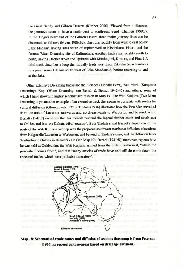
Map 18: Sehematised trade routes and diffusion of sections hasemap is from Peterson
[1976], proposed culture-areas based on drainage divisions
|